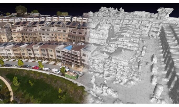
AERIAL Photogrammetry + Thermal Imaging.
A new technology that requires planning, precision and technology to create accurate 3D models for a variety of uses. Asset management is a growing industry and we can produce accurate model for stockpiles and mapping of rural areas, solar farms, Wind farms and crop and water surveys with thermal imaging.